


Tour Planning and Navigation – Part 1
Tools for Success
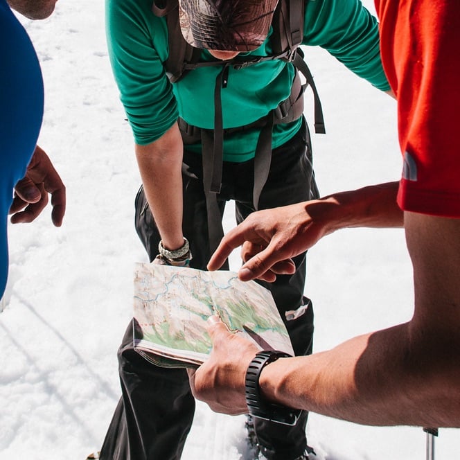
Planning a backcountry ski or climbing trip encompasses a wide range of details that can ultimately define the safety and success of any adventure into the wild. In the field climbers make countless difficult decisions dealing with route options and safety. Why not be prepared for them with a bomb-proof Tour Plan? Here we will detail the materials needed to get you started.


The basic materials for any trip are a good map and compass. Without the ability to interpret them both, route finding would be pretty tricky eh?
We want to have as detailed up to date maps as possible so that major route options and hazards can be easily identified before the trip and found along the way. The United States Geological Survey (USGS) produces multiple series maps covering a vast majority of the United States and parts of other countries. Typically domestic outdoor recreationist use the USGS 7.5 minute scale topographic series maps which offer excellent detail. If traveling in other countries similar map series can be found, some of which will offer even more accurate detail than the maps found in the US, and others well….good luck.


Brooks Range Map Tool. Sweet! In the digital age we can use a few more items to make our planning and route finding more efficient. Knowledge and use of basic GPS units, an altimeter, and a map/utm grid tools will help you create pinpoint accurate plans in little time.
Get yourself an altimeter! This can be one of the most useful planning and navigational tools. I also use this item to help forecast weather events by monitoring the barometer/altimeter at camps. Currently the most common wrist top altimeter watch can be found at just about any outdoor retailer and is made by Suunto. You can also look for a really cool large yellow plastic thing on someone’s wrist at your local rock climbing wall. It’s probably an altimeter watch. Ask them “whats your elevation man?” for me…
A GPS unit can make planning, in conjunction with a computer, super easy. Getting acquainted with these sytems can take time but will create a plan quickly and can be printed out at home custom, with a multitude of different mapping programs. When selecting the right program for yourself realize that they all have there limitations, and one user may prefer one over another, most systems create the same product so it is important to ask around and see what other users recommend with the ever changing technology. Personally I use a basic Garmin GPS unit, in conjunction with the National Geographic TOPO program. This seems to work really well for all of the western US and Alaska. Disclaimer: A GPS is not a replacement for good map reading and compass work! Get really good with your maps.
Now find yourself a Brooks Range (www.brooks-range.com) All –in- One map tool for easy UTM grid reading, and distances on varying scales of maps. This tool incorporates just about all the information you need to formulate an accurate tour plan on almost any type map. Now… put all of this information into a nice weather proof journal. I use the Write in the rain #311 (www.RiteintheRain.com) type book for all planning, forecasting, and snow science reports. That’s a lot of information! Guess what? You will be super excited to have it when making difficult decisions with your friends!
Have fun!
— Ben Traxler, AAI Instructor and Guide