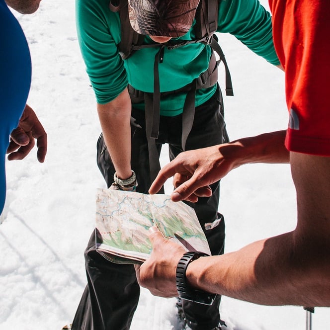
American Alpine Institute offers a wide array of instructional programs, peak ascents, expeditions, and private programs. Browse the different program types here.
Intensive mountain skills instruction and summit climbs
Group Summit Climbs
Programs (8)
Introductory summit climbs with some skills instruction
Expeditions
Programs (36)
Longer trips in remote locations to ascend major peaks, including the Seven Summits
Private & Custom Trips
Programs (42)
Custom adventures for individuals or groups – with the best-trained guides in the industry
Treks, Tours, & Backpacking
Programs (11)
Full-service, non-technical adventures for all outdoor enthusiasts
Government, Military, & Veterans
Programs (3)
Training for government personnel and vocational programs for veterans using VA benefits
Youth Climbing Programs
Programs (3)
Our youth programs inspire young adventurers to explore the outdoors, build confidence, and develop climbing and leadership skills in a fun and supportive environment.
Mountain Center
Programs (5)
Short classroom and outdoor courses, films, lectures, and other low-cost programming for the local outdoor community
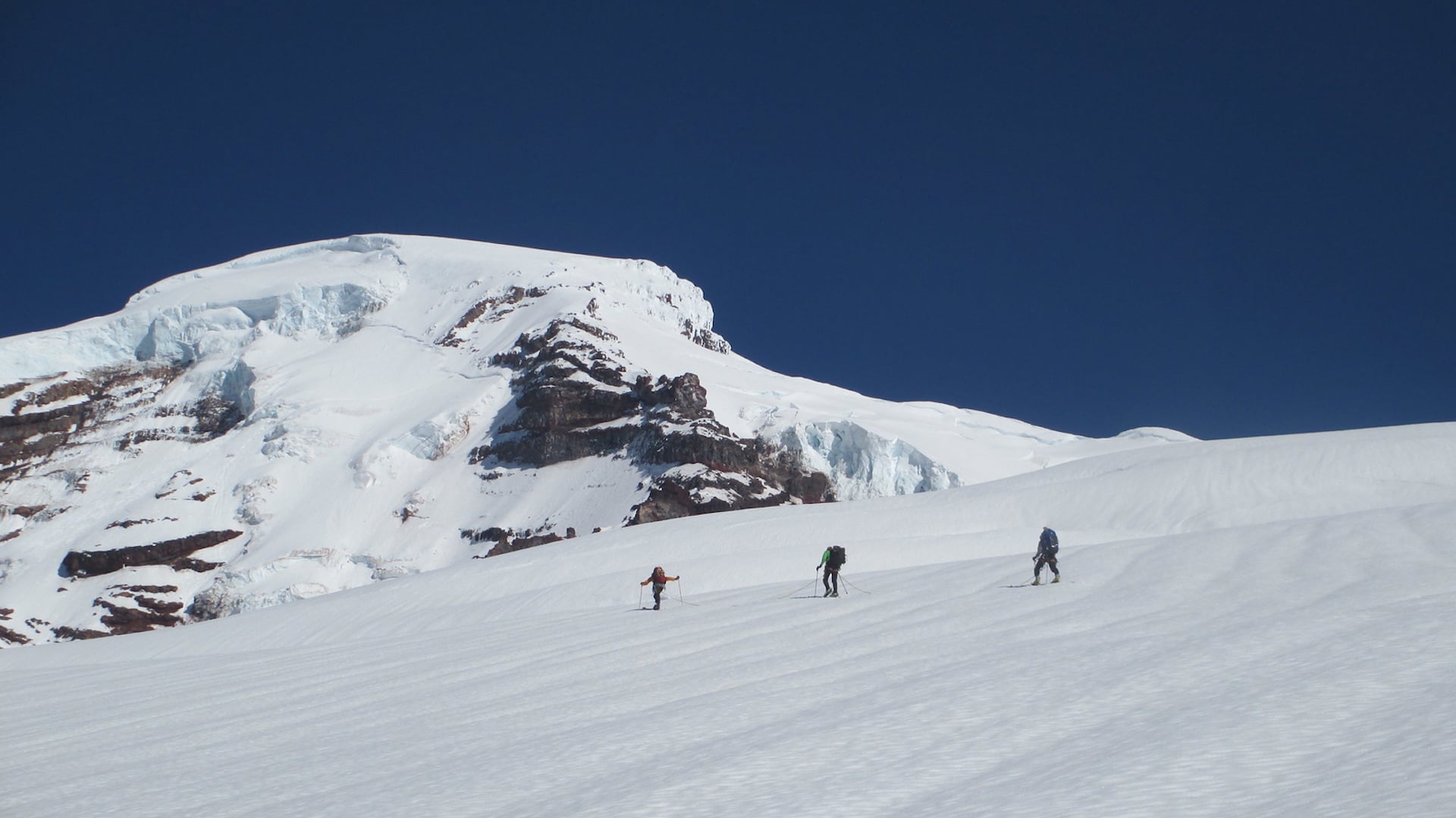
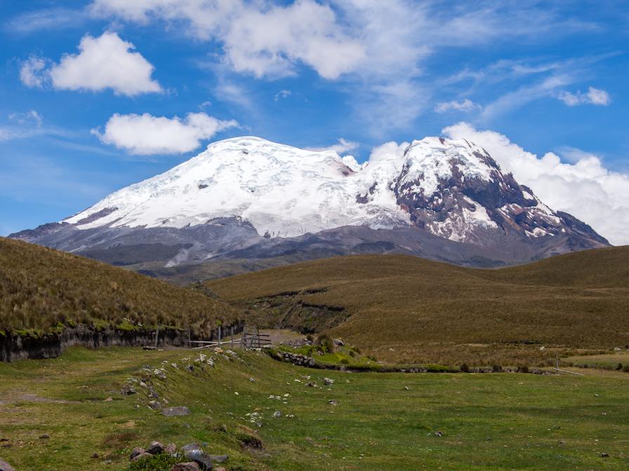
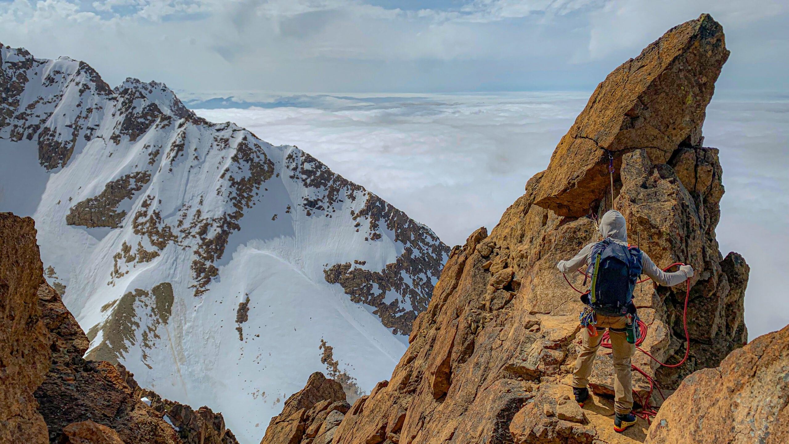
American Alpine Institute offers mountain activities of all kinds, including rock-climbing, ice-climbing, mountaineering, and more. Browse activities here.
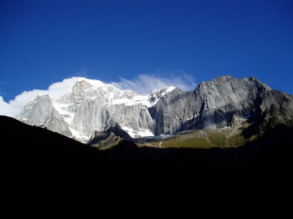
This is mountain climbing in its most classic form – over rock, snow, alpine ice, and glaciers, in pursuit of major summits.
Rock Climbing
Programs (37)
Once mere skill-practice for mountaineers, rock climbing is now a highly developed sport, with numerous sub-disciplines such as trad, sport, and aid.
Ice Climbing
Programs (11)
One of the most fundamental skills of mountaineering, ice climbing comprises skills for tackling both waterfall ice and alpine ice/glacier ice.
High Altitude Climbing & Seven Summits
Programs (31)
Climbing the highest mountains in the world is a special discipline of mountaineering, with unique challenges and rewards.
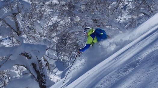
Backcountry Skiing & Boarding
Programs (23)
Guided skiing in world-famous backcountry, and skills instruction for skiers, split-boarders, and ski mountaineers
Avalanche Training
Programs (14)
Avalanche safety training is a must for anyone who ventures into the backcountry in winter, and we offer the gold standard in avalanche education.
Hiking And Backpacking
Programs (15)
Living and moving in the mountains is a reward in itself, and provides the fundamental skills that underlie all mountaineering.
Wilderness Skills
Programs (8)
Those who venture into the wilderness must draw from a deep skill base, including navigation, outdoor cooking, water purification, and countless others.
Outdoor Educator & Guide Training
Programs (15)
Technical and non-technical leadership courses from the AMGA's longest-accredited guide service
Technical Rescue & Medical
Programs (8)
Industry standard technical rescue and wilderness medicine instruction
This demanding expedition combines the worlds of backpacking and mountaineering and has all of the challenges and rewards of both. This trip traces the route pioneered by the Ptarmigan Climbing Club in 1938. The original traverse included ascents of many summits, including Mixup Peak, Mount Formidable, and Dome Peak. This program is offered with the option of summiting one or more peaks.
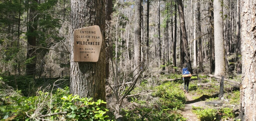
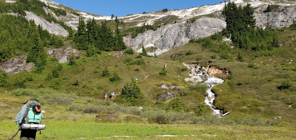
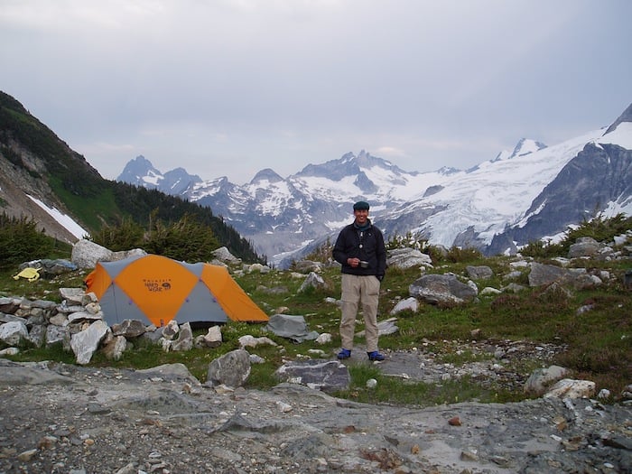
Entering the Glacier Peak Wilderness at the start of the south end of the Ptarmigan Traverse. James Pierson
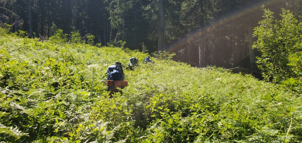
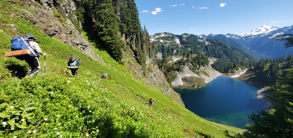
The team making its way through thick, high foliage along the Bachelor Creek drainage. James Pierson
Descending down into Cub Lake during a south-to-north traverse. James Pierson
The rocky and green path leads the group up to Itswoot Ridge. James Pierson
Numerous cascading waterfalls flowing from the toes of dwindling snow patches. Ihor Marushchak
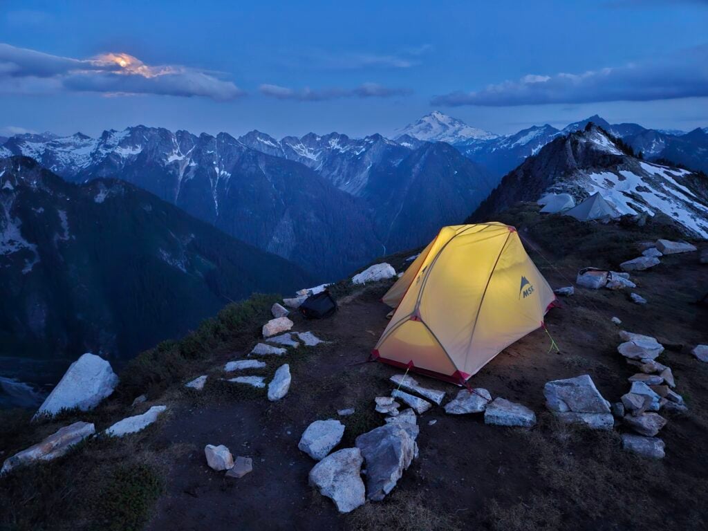
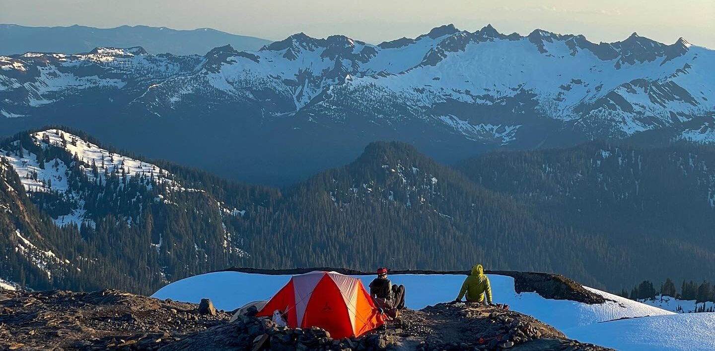
A moon-lit camp along Itswoot Ridge. Ihor Marushchak
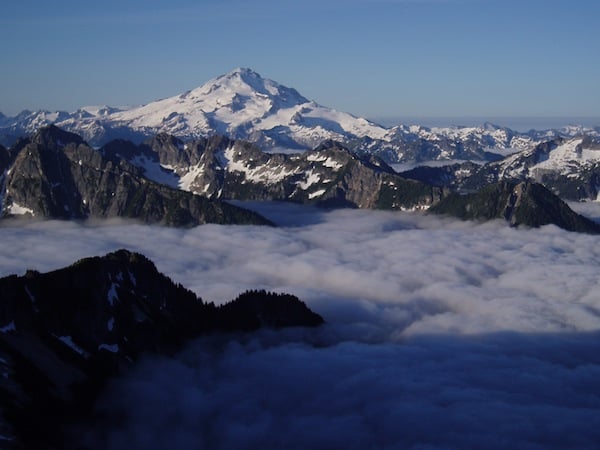
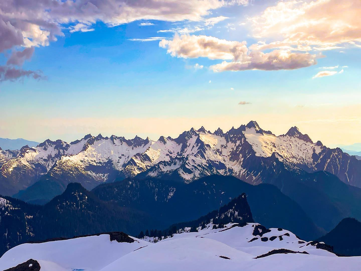
The views throughout the Ptarmigan Traverse are absolutely stunning. In this photo, Glacier Peak floats above the clouds. Myron Allen
Many climbers elect to climb the iconic Dome Peak during their traverse. Myron Allen
This photo was taken from almost the same location as the last one, only 20 years later. Note the reduction in the volume of the glacier towards the lower right of the exposed ice. James Pierson
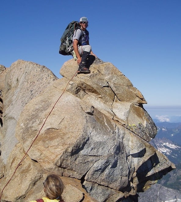
AAI Guide Seth Hobby on top of Dome Peak. Myron Allen
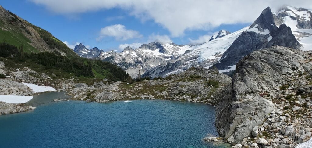
Looking out across the valley from White Rock Lakes Camp. Gunsight Peak with its dual summit hidden in the clouds is middle center, and Elephant Head is the prominent formation to the right. James Pierson
A climber relaxing on the shores of White Rock Lake. Myron Allen
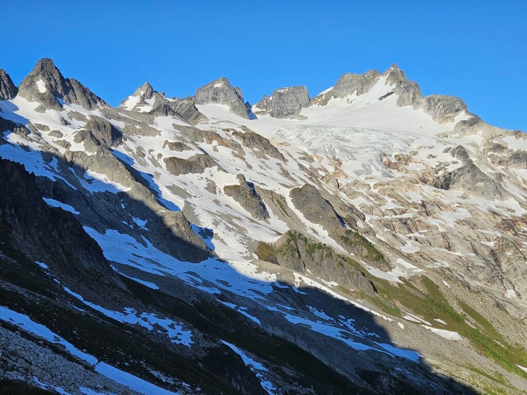
Looking across the South Cascade Glacier with Lizard Peak to the right and Sentinel Peak in the center. James Pierson
The view from high on the slopes of Sentinel Peak, looking across the Chickamin Glacier with the distinct dual-pointed summit of Gunsight Peak to the left and Sinister Peak to the right. Ihor Marushchak
Cascade Pass presents a stunning view of the ridgeline from Magic Mountain on the left to the dramatic exposed granite of Johannesburg on the right. James Pierson
In 1938 a group of mountaineers from the Ptarmigan Climbing Club hatched a plan. Bill Cox, Calder Bressler, Ray W. Clough, and Tom Myers decided to make a high traverse from Dome Peak to Cascade Pass. Over a period of thirteen days the party trekked across glaciers, swam in frigid lakes and made their way to the top of unclimbed mountains, forging an unparalleled route along the crest of the Cascade mountains.
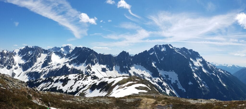
Considered by many to be the most scenic and varied alpine traverse in the country, this route was built specifically for hardy climbers filled with a sense of adventure and in search of a sense of awe. Most AAI teams complete this route in five to seven days, crossing creeks, ridges, cirques, and glaciers between every camp. We often see goats and bears, we view distant peaks, we look for lines up massive rock walls and we stare awestruck at views of violent and complex icefalls.
Most teams attempt a variety of mountains throughout the tour. Some of the peaks are simple detours, whereas others require a “day off” from the traverse. AAI teams regularly ascend a handful of mountains during the trip. Depending on time, parties ascend peaks like Magic Mountain, LeConte Peak, Sentinal Peak, Old Guard, Sinister Peak, Gunsight Peak and Dome Peak.
The Ptarmigan Traverse is remote and scenic and provides enough variety that it can be done as a “high-end” climbing trip, a moderate mountaineering trip, or as a wild backcountry ski tour. No matter how you choose to approach this trip, you will come away having partaken in a historic, beautiful and adventure-filled alpine traverse. Those wishing to escape to this wild venture must be prepared with a full set of mountain tools and experience, including significant backpacking experience, off-trail travel, familiarity with snow and glacier travel, and depending on which peaks grab your interest you will also need experience with rock climbing.
ATTENTION! – Route and Conditions Update – Summer 2026
The winter storms of 2025/2026 caused major flooding and wreaked havoc on many Forest Service roads throughout the Cascades. Unfortunately, the access road to the south side trailhead for the Ptarmigan Traverse was washed out and dramatically damaged. Unfortunately there has not been any updates to the timeline for repair of the road. The washout would add significant mileage of walking the road to reach the southern trailhead. With that in mind, there are currently two options for this program:
“Out and Back” – The trip would start at the northern trailhead at Cascade Pass and the team will head south, climbing and scrambling along the way. Somewhere along the way, the team will turn around and retrace their path back out and return to the northern trailhead.
Western exit – The team would get dropped off at the northern trailhead at Cascade Pass. The team continues south to the South Cascade Glacier and exits via the trail along the South Cascade River. You’ll pass by a dormant research station at the toe of the glacier, ford the headwaters of the River, and cross through grassy meadows until you reach the dense forest. This once overgrown trail used to be mostly bushwhacking through tall undergrowth for the upper portion. However, it was recently recut late in the summer of 2025. Although now more clear, this 2-day exit still has challenging travel along rough, loose pathways, yet provides amazing vistas looking out the South Cascade River drainage.
Regardless of which option the team chooses, objectives during the trip will be discussed as a team and attempts will be determined by ability, weather, and conditions. That being said, attempts on peaks in the southern end of the Traverse, such as Dome Peak or Sinister Peak will be unlikely.
Resources
Click on the buttons to the right to download PDFs and to link to other web resources that will help you prepare for your program.
Some people see the Ptarmigan Traverse trip as an amazing technical hike that also includes a few peak summits. But it is more than that. In reality, this is more of a mountaineering expedition with backpacking in between. While many recreationalists choose to start the Traverse on the north side and go south, AAI often starts on the south side and goes north. One reason we do this is because we meet that first morning at our office and have to go through our equipment check first, take care of any last minute rentals or purchases, then drive to the trailhead. Depending on how long our prep that morning takes, it varies how much time we’ll have to hike on that first day. Since there is that variability on our start time, we have more options for campsites on the south side that can accommodate this. Below is a sample itinerary.
Please note, regardless of which way you start, this is a technical trip with long days that are very physically demanding. Actual distances and camps may have to change to accommodate conditions, weather, or other unplanned factors.
Day One: Downy Creek Trailhead (1440′) to Bachelor Creek Camp (2450′), 4 – 6 Hours
Entering the Glacier Peak Wilderness on the Southern side of the Ptarmigan Traverse. James Pierson
After a bumpy ride down the Suiattle River Road, we’ll start off down the well worn trail and quickly enter the Glacier Peak Wilderness. We’ll hike through the burned remnants of the fire that swept through this area in 2020. It is amazing to witness the regrowth that has already happened so quickly. We hike along with Downey Creek flowing a few hundred feet below us. As of summer of 2025, the trail is mostly clear of debris from the fire and the mudslides that followed, but there is an interesting section of log hopping from a major wind event that will keep our senses (and balance) engaged! As noted above, there are a few places to camp along the way if time is a constraint on that first day, but the goal is to make it to the confluence of Bachelor Creek and Downey Creek.
Day Two: Bachelor Creek Camp to Itswoot Ridge Camp (6,350′) 9-12 Hours
The team making its way through thick, high foliage along the Bachelor Creek drainage. James Pierson
Starting off this day from the steep trail alongside Bachelor Creek, you’ll wind your way up the valley, trekking in and out of forest coverage, navigating through patches of thick vegetation, and eventually breaking through into meadows as you get closer to the ridge above Cub Lake. After a steep switchbacking hike down to the lake, you’ll traverse along the basin floor before one final steep push up to the amazingly scenic camp on the ridge. You’ll have views of Dome Peak, Glacier Peak, and even beyond.
Optional Summit Day (A): Ascent of Dome Peak
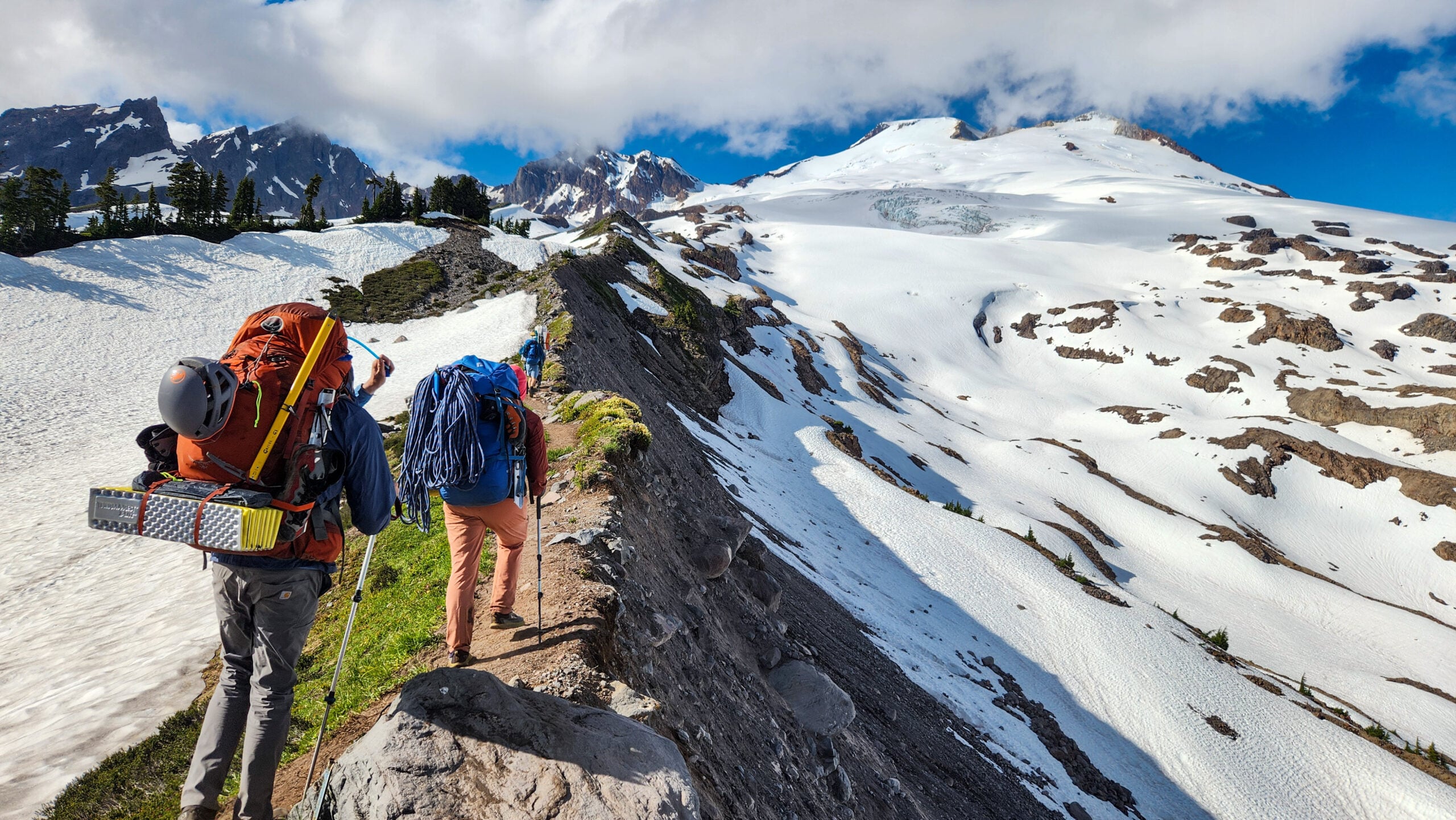
This day can be added into the core itinerary to allow for a summit attempt of our first big peak. Most parties will climb Dome Peak (8,924′), but Sinister (8,440′) and Gunsight Peaks (8,198′) are also options. If a party wants to focus on climbing in this excellent area, they may elect to spend multiple days at this camp or even move camp closer to the Dome Peak area to focus their climbing efforts here.
The Dome Glacier Route is the most popular line on Dome, with thirty-five degree glacier travel and a few third class moves, but there are some other harder options on the South Face of the summit pyramid if there is interest in rock climbing.
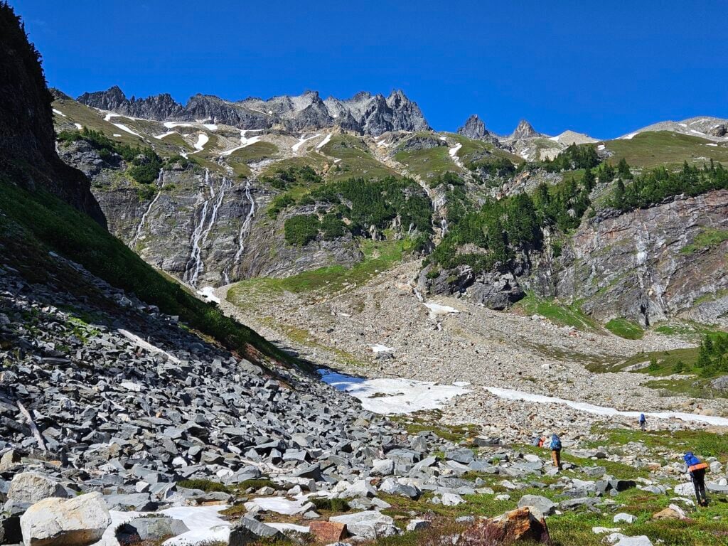
Day Three: Itswoot Ridge (6,400) to White Rock Lakes (6,200′) 7-9 Hours
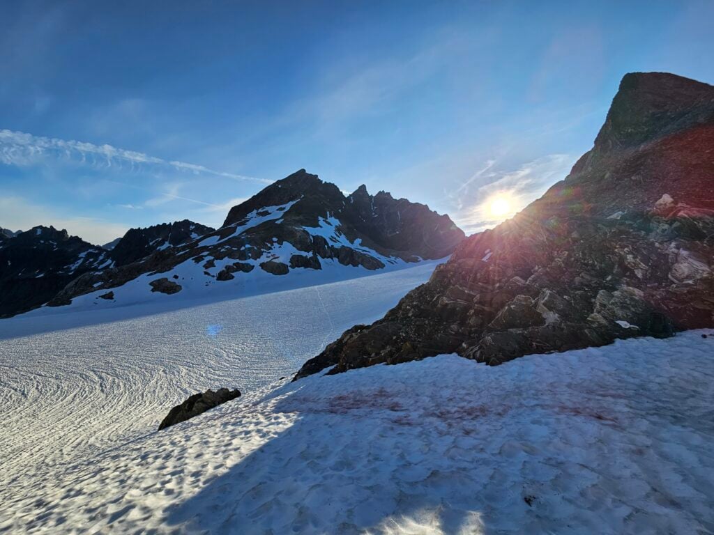
The simple glance at the camp elevation numbers belies the more complex nature of this leg of the Traverse. From camp you’ll wind your way up through gullies and pocketed snowfields broken by rocky bands as you make your way up to the saddle below Spire Point at 7,800′. From here, you’ll start your descent of the Dana Glacier, trending to the north and eventually traversing gently clockwise around the bowl that drains into the West Fork of Agnes Creek. Once you eventually cross the creek at about 5,600′, you’ll start to gain elevation again back up to Whiterock Lakes. The views back to the south across the valley toward Gunsight and Sinister are spectacular.
Looking out across the valley from White Rock Lakes Camp. Gunsight Peak with its dual summit hidden in the clouds is middle center, and Elephant Head is the prominent formation to the right. James Pierson
Optional Summit Day (B): Ascents of Sentinel Peak (8,260′) and Old Guard Peak (8,240′)
Here is another opportunity to include a day in the itinerary for summit attempts. However, those who wish to take a day off to enjoy the mountains instead of climbing would be welcome to do so.
From White Rock Lakes we will work our way back to the South Cascade Glacier where we will make an ascent of the Southwest ridge of Sentinal Peak. This line requires some low to mid-fifth class climbing with a little bit of steep snow. Climbers should have previous rock climbing experience, be comfortable moving through loose rock and having dramatic exposure, but it provides possibly one of the best views of the entire traverse.
The view from high on the slopes of Sentinel Peak, looking across the Chickamin Glacier with the distinct dual-pointed summit of Gunsight Peak to the left and Sinister Peak to the right. Ihor Marushchak
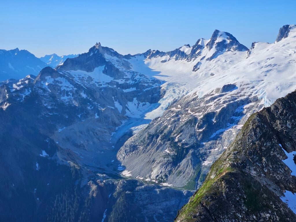
The expansive Chickamin Glacier with Gunsight and Sinister lies to the southeast, Glacier Peak in the distance to the southwest, and if the day is clear you might even glimpse Mt. Rainier beyond that. Then continuing around to just below you in the west is the South Cascade Glacier with the pyramidal Hoch Joch Spitz teasing you. Buckindy and Snowking lies just a few ridgelines away, and in the distance to the northwest you might be able to make out Mt. Baker and Mt. Shuksan. Continuing to clock around, you’ll see Eldorado, Forbidden, and the other peaks of the Boston Basin area to the north. And then finally to the east lies the impressive Agnes Creek drainage, which flows into Stehekin Creek and eventually becomes Lake Chelan.
Once ready to return, we will then descend to the LeConte Glacier where we will make a second ascent. This will be of the east ridge of Old Guard Peak. Two pitches of mid-fifth class climbing will bring us to a classic summit in the heart of the Cascade Range. We’ll descend to the Le Conte Glacier and traverse around counter-clockwise to the western side of Sentinel, across the glacier, and back down to camp at the Lakes.
Day Four: White Rock Lakes (6,200′) to Yang Yang Lakes (5,830′) 7-11 Hours
We’ll pack up camp and ascend to Lizard Pass, cross the South Cascade Glacier, and retrace our steps around Sentinel to the the Le Conte Glacier. From here, we’ll maintain a steady traverse along the northeast side of the Le Conte Ridge until reaching the northern shoulder of the Northwest Summit. If time allows, we may be able to make a quick ascent of that Northwest Summit, a 3rd and 4th class scramble with some steep snow.
From the north shoulder, we’ll continue with a slight descent to a saddle on the ridgeline at 6,500′, and then continue along the ridge for about half a mile, avoiding the steeper slopes below. From there, we’ll follow the moraine of the snowfield that drains into Flat Creek and drop down into camp from there. If there is adequate snow coverage, we may not need to go so high up the ridgeline before dropping down, which could save time and energy.
Day Five: Yang Yang Lakes (5,830′) to Kool Aid Lake (6,120′) 8-11 Hours
From our camp and Yang Yang Lakes, we’ll make a rising traverse, circling around the basin to the easternmost notch in the ridge at 7,300′ between Mount Formidable (8,325′) and Spider Mountain (8,286). From the Spider-Formidable Saddle, we drop into the Middle Cascade Glacier and traverse around to the right of this northwest-facing bowl. Once we exit the edge of the glacier, we’ll continue with a steady traverse that meanders between 6,200 and 6,400 feet, and then head around the western ridge of Art’s Knoll. On the north side of that west ridge we’ll pass along the infamous “Red Ledges”, a large red scar in the black rock spur below the main summit of Art’s Knoll. The Ledges are a bit of Class 3 scrambling known for their exposure, but the ledges themselves are broad and easy, unless covered with snow. Once through the Ledges, we’ll continue the steady traverse down through heather and talus to the good camp sites at Kool Aid Lake.
Day Six: Kool Aid Lake (6,120′) to Cascade Pass Trailhead (3,600′) to 6-8 Hours
On this final day of the Traverse, we’ll make our way along slopes of hardy meadows of heather and pocked patches of talus below the upper western bowl of Magic Mountain. Aiming for the gradual weakness in the western edge of that bowl, we start up a slightly steeper traverse to Cache Col (6,900′). With the last of the significant uphill travel behind us now, we start the diagonal descent down the Cache Glacier. We’ll pass below Mixup Peak and slowly trend down towards the eastern side of the norther arm of Mixup until reaching the broad saddle of Cascade Pass (5,390′). The massive exposed granite walls of Johannesburg Mountain rise up from the valley below you to the northwest, and you’ve got equally impressive views of Boston Basin, Mt. Torment, and Forbidden Peak as well. If you’re lucky, you might be able to catch a glimpse of the trailhead from here. But don’t let that distract you too much. We’re close, but we’re not done yet! Our home stretch down to the trailhead concludes with over 30 switchbacks down through the forest to the valley below, dropping over 1,700′ in about 3.5 miles.
Cascade Pass presents a stunning view of the ridgeline from Magic Mountain on the left to the dramatic exposed granite of Johannesburg on the right. James Pierson
Details
Prerequisites
Multi-day backpacking experience
Off-trail travel experience
The ability to cook for yourself on a backpacking stove
Experience with glacier travel, crampon and ice axe techniques, and crevasse rescue
Familiarity with self-arrest maneuvers
Very good physical fitness: carrying heavy packs (45+ lbs) for multiple days, 6 – 12 hrs per day
Inclusions: Guide, group climbing gear, backcountry permit fees, front-country camping fees (if applicable) and transportation. A live Zoom gear consult is also included.
Exclusions: Travel and lodging before and after the trip, personal climbing and camping gear, food, and guide gratuities.
On our public group trip we complete the route at a 3:1 climber to guide ratio.
Private Options
The Dana Glacier near Spire Point
The Ptarmigan Traverse can also be done as a private program, based on your personal dates and itinerary. For a more personalized experience, our private trips offer tailored instruction and flexible itineraries to match your goals and abilities. Whether you’re looking to explore challenging terrain, practice advanced skills, or simply enjoy a quieter, more focused adventure, a private trip gives you one-on-one guidance from expert instructors, unlocking experiences that are uniquely suited to you. The prime season for doing a mountaineering-focused the Traverse are from early July through mid/late August. See details on booking here.
Please note that while we can assist in setting up transportation for a private traverse, transportation is not provided and that setting up transportation (car shuttles) before and after a private trip may take up to half-a-day on each end.
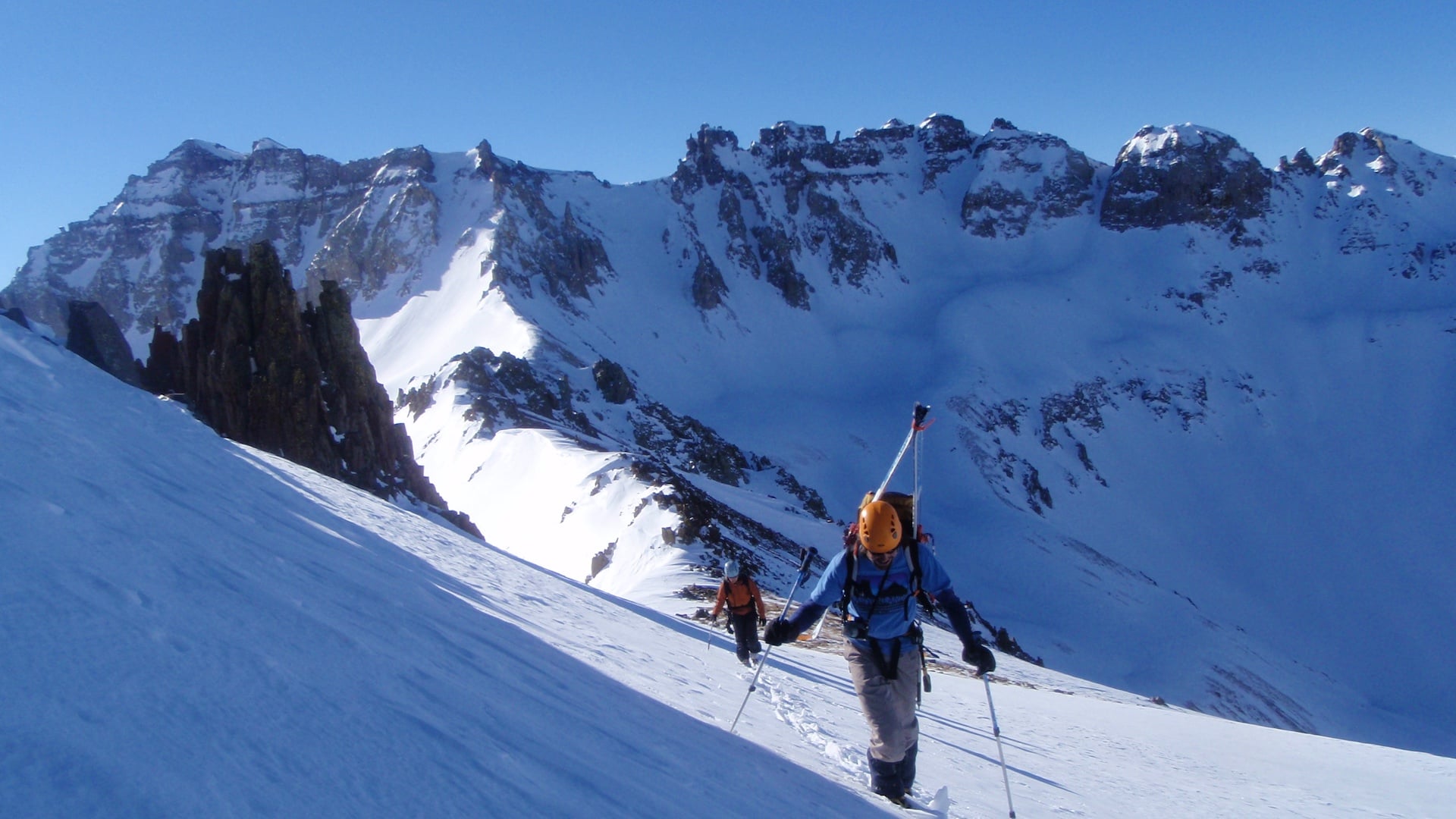
Skiing The Traverse
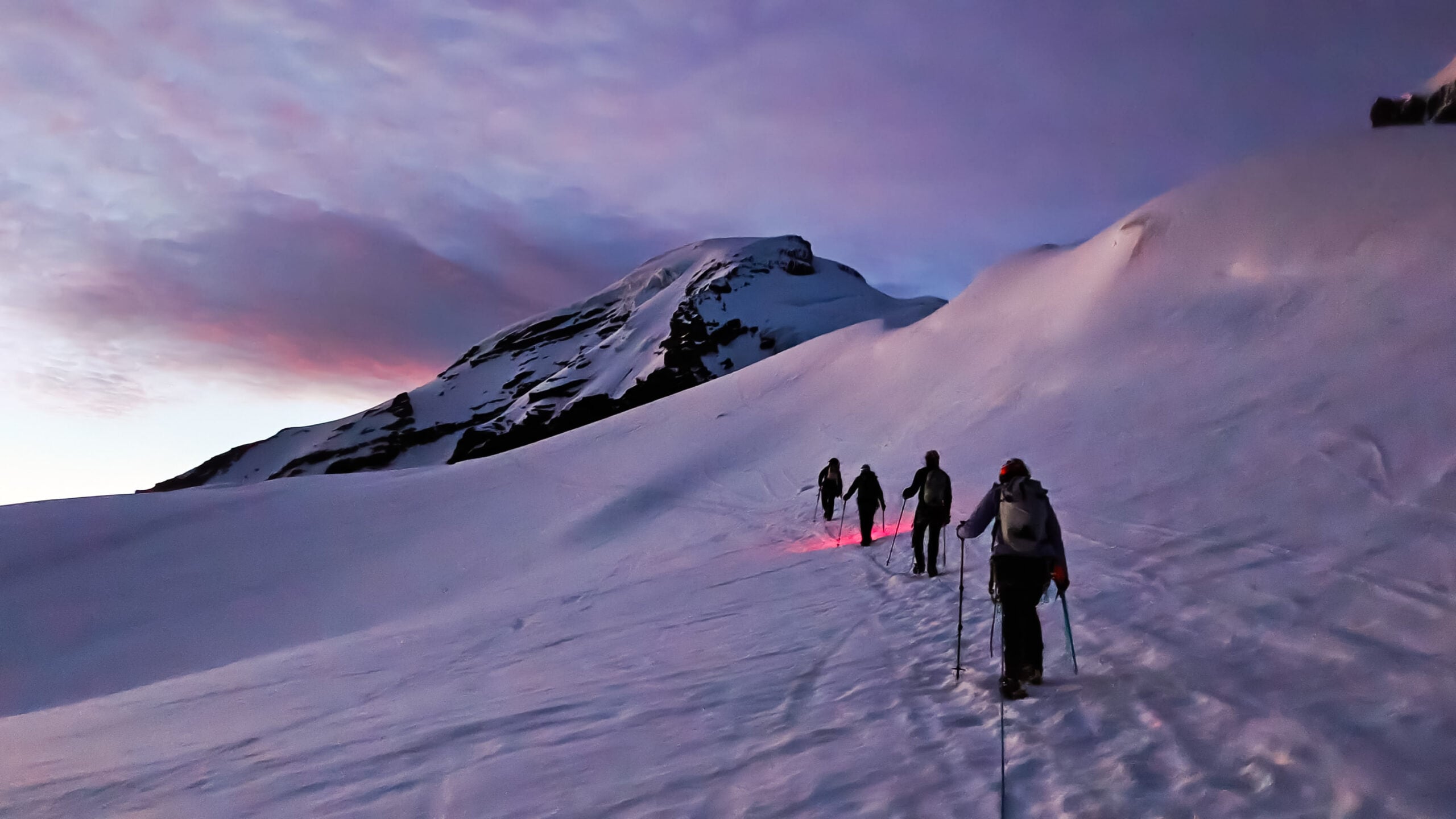
Over the last few years the Ptarmigan Traverse has become a popular ski objective. This is usually done from starting on the north end and, depending on the time of the year and the snowpack, can be done as a standard traverse, or more frequently is done as “out-and-back” where you do not fully go through the traverse and instead, you return to the north trailhead. The “out-and-back” allows you to assess conditions and coverage on the way out and then ski the many north-facing glaciers on the way out and is usually the choice for earlier in the season when the roads on the south end of the Traverse are still covered in snow. This makes sense as most of the route lives in the “blue run” world, with a few spots sporting single “black diamond runs.” Backcountry skiers who are comfortable on 35-degree terrain in variable conditions with a multi-day pack on should be capable of competently completing this traverse.
The number of days required for the traverse will be determined by the amount of snow coverage. Heavy snow coverage can be great on the main part of the tour itself, but it can also add time and miles to the approach and exit. The south end of the traverse currently requires a fair bit of bushwacking and road walking. If this is snow-covered, some of the tree-skiing could be difficult, but movement on open trails and old roads would be quite fast.
Other parties choose to descend back to the Cascade River Road via the South Cascade Glacier. Depending on snow coverage and avalanche conditions, this can provide an alternative to retracing ones steps back to the end of Cascade River Road or to descending into Downey Creek.
Ptarmigan Ski Season
The season for skiing the Ptarmigan Traverse is usually April through June, though some years it is possible to ski the bulk of the traverse well into July.
The Ptarmigan Traverse is offered as a private ski program that runs from four to seven days in length. The length of the trip is determined by the number of peaks that you wish to climb and ski while traversing the route. Private rates apply.
Prerequisites for the ski traverse:
Very good physical fitness: carrying heavy packs (45+ lbs) for multiple days, 6 – 12 hrs per day
At least one full season (+20 days) backcountry skiing experience
Ability to ski black-diamond terrain
Experience skiing in a variety of conditions (powder, hardpack, breakable crust, etc)
Experience with glacier travel, crampon and ice axe techniques, and crevasse rescue
Multi-day backpacking experience
The ability to cook for yourself on a backpacking stove
Recommended to have taken a level 1 avalanche course and an avalanche rescue course
Inclusions: Guide, group climbing gear, and backcountry permit fees.
Exclusions: Travel and lodging before and after the trip, personal climbing, skiing and camping gear, food, and guide gratuities. Additionally, if you choose to do the complete traverse and not just the tour, there will need to be transportation available on both ends.
Please note that setting up transportation (car shuttles) before and after a private trip may take up to half-a-day.
This immersive two-day course is the perfect starting point for hikers and outdoor enthusiasts who are new to overnight camping in the mountains. Participants gain the skills and confidence to … Read more
Our private and custom backpacking trips will have you enjoying some of the most remote and inspiring alpine scenery in North America. From lush valley floors covered with old-growth fir … Read more
Alpinism 1 is our most popular entry-level mountaineering course, designed for anyone ready to step into glaciated peaks and alpine environments. Whether you’re dreaming of climbing Mount Baker, aiming for … Read more
Few experiences compare to standing on the summit of a glaciated peak, and Mount Baker is one of the most accessible big mountains in North America. In just 3 or … Read more
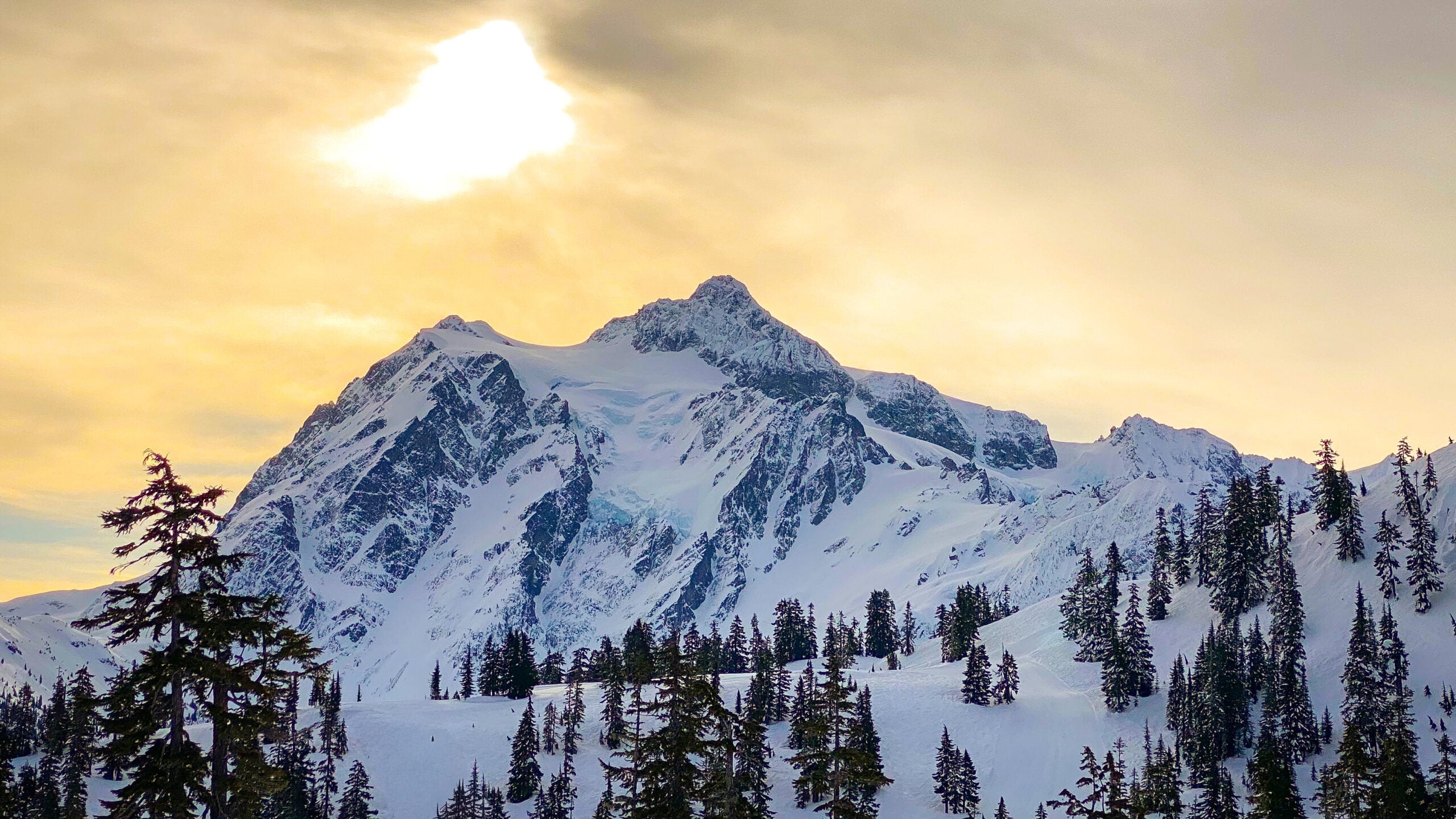
Mount Shuksan is widely considered one of the most beautiful mountains on Earth, and for good reason. This iconic North Cascades peak has dramatic steep faces, sparkling hanging glaciers, lush … Read more
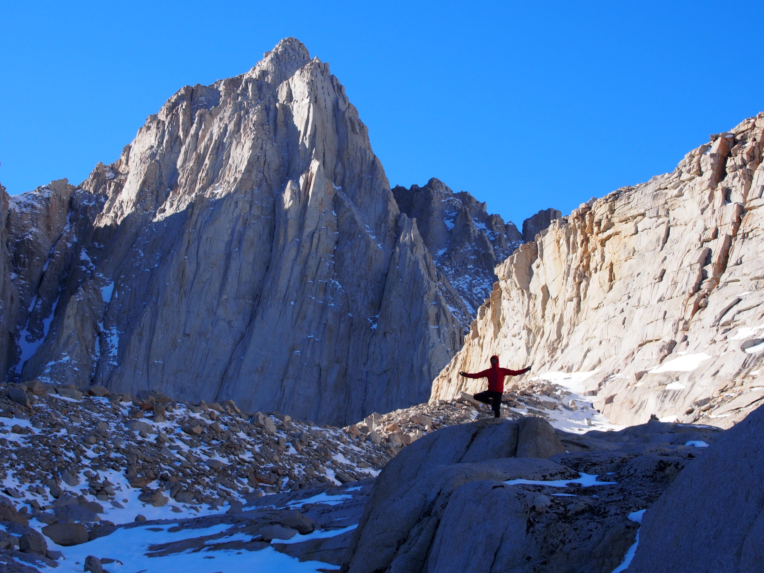
Mt. Whitney is the highest point in the lower 48 states and the crown jewel of California’s Sierra Nevada. Climbing Mt. Whitney lets you experience one of America’s most beautiful … Read more