Guided Alpine Climbing in the Swiss Alps
Routes and Peaks
Routes are broken down into:
- Introductory Ascents
- Moderate Ascents
- Intermediate Ascents
- Advanced Ascents
Introductory Ascents
The routes described in Level 1 are not highly technical and only require previous backpacking experience when climbing with a guide; climbers without complete knowledge of basic alpine skills should not attempt them without a guide. These ascents offer beginners an introduction to glacier travel and basic snow climbing.
Breithorn – S. SW Flank: F, 370 m
The Breithorn, or "Broad Peak," is aptly named. Its summit ridge runs for 2 1/2 kilometers along the Zermatt watershed without dropping below 4000 m, and contains four subsidiary peaks that are worthy of consideration. With its hugely varied terrain and easy access from Zermatt via the Klein Matterhorn lift system, the Breithorn provides among the most appealing array of routes found on any of the 4000 m peaks in the Alps.
The highest of the Breithorn's four summits can be attained via a straightforward glacier climb on 35˚ terrain, making for a fantastic introduction to alpine climbing. Taking the Klein Matterhorn lift up from Zermatt, climbers attain the Breithornpass then climb to the SSW flank and on to the summit. The climb takes 1 1/2 - 2 hours, while the descent takes roughly 1 hour.
Mönch – S.E. Ridge: PD+, 578 m
The Mönch, or "Monk" of the Bernese Alps is the center peak of the Oberland Wall, which stands above the Grindelwald and Lauterbrunnen valleys, flanked by the Eiger and Jungfrau. The standard route on the Mönch, the South-East Ridge can be approached from either the Obers Mönchsjoch hut, or the Jungfrau train station. In either case, the relatively short route is easily completed in a day, taking between 2 1/2 and 3 1/4 hours on the ascent, and roughly 2 1/2 hours on the descent for most parties. This is an excellent peak to climb as your brush up on your alpine skills, or as an acclimatization peak in anticipation of climbing other objectives.
The route itself begins with a rock and mixed-ground scramble up to the S.E. Ridge, turning Northwest along the arête and passing a subsidiary peak en route to the summit. The final snow ridge is quite narrow, and is extremely delicate if corniced or in poor condition. The exposure of the final ridge makes this a route to be taken seriously, despite its accessability and relatively short length.
Allalinhorn – W/NW Ridge: PD-, 540 m
The Allalinhorn's position as the lowest of the 10 4000m peaks on the western side of Saas Valley combine with its distinctive outline expansive glacial setting to make it one of the most appealing and accessible introductory climbs in the Swiss Alps.
Climbers will depart the Mittel Allalin metro station at 3454 m, passing below the ice cliffs at the foot of the Northeast Rideg, before climbing a short, steep slope and navigating past a large crevasse. Continuing on with a rightward traverse, we will reach the Feejoch at 3826 m, where we will turn East/Southeast and ascend snow slopes toward the summit. The ascent takes roughly 2 hours to complete, and 1 1/2 hours should be allowed for the descent back to Mittel Allalin.
Weissmeiss – W/NW Flank: PD, 950 m
As the furthest East of the 4000 m peaks in the Valais, Weissmeiss' summit provides an uninterrupted view to the italian lakes and plains to the South, and a panoramic view of more 4000 m peaks than any other summit in the area. The climb itself is slightly more difficult than those of the Breithorn or Allalinhorn and has the advantage of being in a minor rain shadow, making it an excellent choice of outing on days when other accessible peaks are clouded in.
The standard route up the Northwest Flank begins at the Hohsaas station, gaining and crossing the Trift Glacier at 3260 m to the base of the NW flank. Crevasses and seracs high on the face of the peak create some objective hazard during this part of the ascent, and conditions vary greatly from year to year so it is best be be certain of the current situation before embarking on this climb. Turning right and traversing under a high ice cliff, one ascends through crevassed slopes to gain the easier ground and open snow slopes above. From here, climbers gain the SW ridge at a broad saddle, staying left of the cornice line to gain the summit dome. The climb typically takes 3 - 3 1/2 hours, and 2 hours should be allowed for the descent.
Moderate Ascents
The ascents at this level are not highly technical, but the snow and ice routes cross major glaciers, and the rock ascents involve multiple pitches. You should have basic glacier travel, ice axe, and cramponing skills for these climbs.
Wellenkuppe: PD, 705 m
The Wellenkuppe is a two day climb from Zermatt, with the first day spent approaching the Rothorn Hut, which takes roughly 5 hours. The next day, we rise early and cross the Trift Glacier to the East side of the Wellenkuppe. We transition to rock climbing and ascend the low slopes, then join the East ridge for the final pitches of rock, which are low 5th class, steep, and of the highest quality. A short snow and ice slope will bring us to the summit, and exceptional views of the Obel Gabelhorn and Zinal Rothorn. The climb from the Rothorn takes about 2 1/2 hours.
Monta Rosa – Dufourspitz W Ridge: PD+, 1840 m
The Dufourspitz is the highest peak on the tallest massif in Switzerland; of all the mountains of the Alps, it is second in elevation only to Mont Blanc. Monta Rosa's East face provides a striking contrast to the gentler mountain flanks surrounding Zermatt, as it drops 2000 m in less than 3km making it the largest steep snow face in the Alps in terms of height and scale.
Unsuprisingly, even the most accessible routes up such a massive peak are long, and demanding of endurance and determination. The West Ridge of the Dufourspitze provides the best access to the peak; the route begins with a lengthy glacier climb to the base of the ridge itself. Once the ridge is gained, climbers are treated to a spectacular mix of climbing on narrow snow aretes and solid gneiss, and unparralleled views that range from Italy in the South to Mont Blanc in the West.
Intermediate Ascents
These ascents call for more technical skill than the Level 2 climbs. They present challenges for climbers still gaining some of their initial experience, but who are thoroughly versed in the fundamentals of alpine technique. You should have solid intermediate alpine skills for rock, snow, and ice. Rock ascents are multi-pitch climbs up to 5.6 in difficulty, and snow and ice routes may have sections up to 60 degrees.
Zinalrothorn – SW Ridge: AD+, 1350 m
The Zinalrothorn, situated between the Matterhorn and the Weisshorn, is known for offering some of the highest quality rock in the Alps. It is a climber's mountain, with three ridges of brown gneiss approaching the summit from the Southeast, Southwest and North.
The Southwest ridge, also called the Rothorngrat, can be approached from either the Rothorn or Mountet huts, though the approach from the Rothorn Hut has become more involved of late, due to shrinkage of the Trift glacier. The route itself follows the ridge, passing over a series of gendarmes and requiring an array of techniqes ranging from slab to chimney climbing. The route should be expected to take between 6 and 7 1/2 hours.
Weisshorn – East Ridge: AD, 1570 m
Due to its remoteness, nearly perfect shape, and clean lines, the Weisshorn is considered by some to be the pinnacle of Alpine experiences. There are no ski establishments or cable cars to ease access or distract from the objective, and even the most direct ascent route requires 2830 m of climbing. That route is the East Ridge, which splits the South and Northeast faces of the massive pyramidal mountain.
From the Weisshorn hut, 2 1/2 hours of climbing through varied terrain and tricky navigation will gains the East Ridge. The crest of the ridge is followed past a series of rock teeth, and narrows before steepening and broadening again. Climbers will negotiate a bergschrund high on the slope, then continue on toward a final section of rock and the summit. From the hut, allow 6 - 7 hours for this climb, and up to 5 hours for the descent.
Advanced Ascents
These climbs include some of the most exciting and challenging routes in the Alps, and require a complete repertoire of snow and ice or rock climbing skills, the ability to perform them without error, and excellent physical condition. Before attempting any of these climbs, we highly recommend that you warm up on one or more less difficult routes. Maximum ratio of 1:1 where noted.
Ober Gabelhorn – E NE Ridge: AD, 1560 m
The Ober Gabelhorn yields a margin of notoriety to its neighbors around Zermat, but it holds ridge and face routes to rival the quality and aesthetics of any of its neighbors. There is no 'easy' way up this peak; its steep flanks and dividing ridges both entice and challenge.
The East/Northeast ridge is the standard route if accessing the summit from Zermatt, and is climbed from the Rothorn hut starting with an ascent of the Wellenkuppe, as described above. From the summit of the Wellenkuppe, we will descend to the col dividing the two peaks, and ascend the gendarme which obstructs the ridge. The climb transitions to an easier snow arete beyond the gendarme, leading to the final rock pitches and summit. The climb takes 5 - 6 hours, and we will allow 4 - 4 1/2 hours for the descent back to the hut.
The Matterhorn – Hörnli and Italian Ridges (Maximum 1:1)
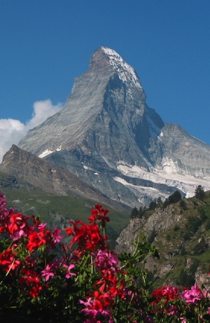
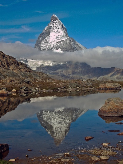
This is a peak that comes close to needing no introduction. It is perhaps the most famous mountain other than Everest, and it is easily the most recognized peak in the world. It's tapered, pyramidal silhouette rises some 1200 m above the surrounding ridges, emphasized by its relative isolation. Add to that its nearly unequalled stature in the history of alpinism, and you have the makings of a beautiful and serious peak that holds a draw for innumerable climbers around the world.
Hörnli Ridge: AD 1220 m
The Hörnli Ridge is a an exposed, technical scramble of enormous proportions and consequence. The lower half of the route feels exposed for the relatively non-technical nature of the terrain, but involves complex routefinding. The delicate Lower and Upper Mosely Slabs lead around 4000m lead to the Solvay bivouac hut, past which the route follows the ridge crest with some enjoyable scrambling. Passing the final rock bastion on fixed ropes, parties ascend a 45 - 50 degree icefield to the summit. The climb generally takes 4 - 5 1/2 hours, and 4 - 6 hours should be allotted for the descent.
Italian Ridge: AD+, 650 m
The Italian Ridge is a fine climb, more difficult and aesthetically cleaner than the more popular Hörnli ridge. It includes several fantastic rock pitches; all of the difficult sections are well protected with fixed ropes, chains and stanchions, making the climbing efficient and secure. By using the Klein Matterhorn-Testa Grigia lift system, Zermatt based parties are able to make a 2 day traverse of the Matterhorn, which is certainly one of the finest outings available in the Alps.
From the Carrel hut, the route climbs ledges and slabs out the ridge toward a minor summit known as the Pic Tyndall, and the beginning of a fairly level shoulder section. We traverse the crest of the shoulder to the summit bastion, and begin the most demanding sections of our climb. Roughly five pitches and some sections of simul-climbing (all of which features optional fixed protection) bring us to the base of the Italian Summit, which is reached via 50 m of rock steps; the narrow rock summit ridge brings us to the higher Swiss Summit. The descent to the Carrell hut taks 4 - 5 hours, and can be accomplished by downclimbing the fixed protection, or a mix of downclimbing and rappelling.
Eiger – South Ridge: AD, 1650 m
The Eiger joins the Jungfrau and the Mönch as part of the proud alpine wall that stand high over the well known town of Grindelwald. It is another peak that needs no introduction, as images of its brooding Nordwand (North Face) are iconic both in our popular culture and collective imaginations. The first ascent of the Eiger was accomplished via the West flank in 1858, but the North Face wouldn't be conquered until 1938, a full 80 years later.
Fortunately, not all of the routes up the Eiger remain as daunting as the Nordwand; though it remains a considerable climb, the South Ridge provides comparably ready access to this peak. It is a climb best accomplished in two days, with the first day being spent taking the Jungfaujoch railway to it's highpoint, then proceeding across the Jungfraufirn to the Mönchsjoch hut. The next day necessitates an early start, as we have a great deal of moving to do. We begin by attaining the South Eigerjoch, from which point the climbing kicks up a notch, as we follow the rock ridge to the North Eigerjoch. As we scramble up the ridge, we switch from the familiar gneiss of the Mönch to moving on the limestone and shale of the Eiger. The final push to the summit steepens, and we will rope up for several belayed pitches of engaging climbing on our way to the top. This route can be expected to take 7 - 9 hours on the ascent, and as long as 7 hours to descend.
